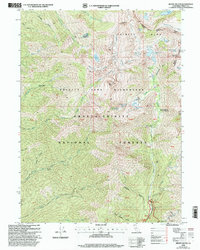
1998 Map of Mount Hilton
USGS Topo · Published 2003About this map
Trinity Alps Wilderness dominates this late-twentieth-century landscape, characterized by high-elevation permanent snowfields and glacial lakes. The drainage of the North Fork Trinity River and Canyon Creek reveals a history of remote mountain activity, from high-altitude camps like Enos Camp and McKay Camp to abandoned dwellings at Russell Cabin (Site) and Stonehouse (Site). Geologic interest is evident in the numerous resource extractions scattered throughout the steep gulches, including the McClaron Mine, Alaska Mine, and Chloride Mine. The map details a transition from recreation-focused areas like the Ripstein Campground to the high peaks of Mount Hilton and Sawtooth Mountain. Unique hydrological features are documented, such as The Sinks on Canyon Creek and the Forbidden Lakes, illustrating the complex water patterns of the Shasta-Trinity National Forests.
Find a feature on this map
51 named features on this map. Tap any name to fly to it.
Don’t see what you’re looking for? This feature index may not catch every label — zoom into the map to look around manually.
Map Details
Editions of this 1998 Mount Hilton Map
This is the sole edition of this map. No revisions or reprints were ever made.
Other maps of this area

1886 · Shasta
USGS Topo · 1:250,000

1890 · Red Bluff
USGS Topo · 1:250,000

1894 · Red Bluff
USGS Topo · 1:250,000

1894 · Shasta
USGS Topo · 1:250,000

1909 · Big Bar
USGS Topo · 1:96,000

1913 · Weaverville
USGS Topo · 1:125,000

1915 · Big Bar and Vicinity
USGS Topo · 1:250,000

1923 · Sawyers Bar
USGS Topo · 1:125,000

1931 · Etna
USGS Topo · 1:96,000

1934 · Etna
USGS Topo · 1:125,000