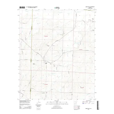
2014 Map of Mount Holly
USGS Topo · Published 2014About this map
Mount Holly serves as the focal point of this western Union County landscape, where the local economy and geography are defined by a network of petroleum resources and small family burial grounds. The surface is partitioned by the Mount Holly Oil and Gas Field and several related extraction zones, including the Salem Church Oil and Gas Field and the West Mount Holly Oil and Gas Field. These industrial areas exist alongside numerous small cemeteries that reflect the area's generational settlement, such as Mt Holly Cem, Salem Church Cem, and Smeed Cem. The land is drained by a dense system of waterways, most notably Smackover Cr to the north and Wickham Cr to the south. Transportation is facilitated by local routes like Stephens HWY and Old Camden RD, which connect these rural homesteads and industrial sites within the timbered terrain of southern Arkansas.
Find a feature on this map
67 named features on this map. Tap any name to fly to it.
Don’t see what you’re looking for? This feature index may not catch every label — zoom into the map to look around manually.
Map Details
Editions of this 2014 Mount Holly Map
This is the sole edition of this map. No revisions or reprints were ever made.
Other maps of this area

1953 · El Dorado
USGS Topo · 1:250,000

1957 · El Dorado
USGS Topo · 1:250,000

1958 · El Dorado
USGS Topo · 1:250,000

1960 · El Dorado
USGS Topo · 1:250,000

1962 · Lisbon
USGS Topo · 1:24,000

1962 · Louann
USGS Topo · 1:24,000

1962 · Buena Vista
USGS Topo · 1:24,000

1962 · Mt Holly
USGS Topo · 1:24,000

1964 · Louann
USGS Topo · 1:62,500

1966 · Village
USGS Topo · 1:24,000