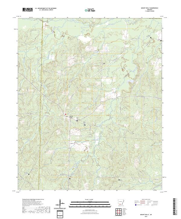
2024 Map of Mount Holly
USGS Topo · Published 2024About this map
Mount Holly serves as the primary settlement in this corner of southern Arkansas, situated along the county line between Columbia and Union counties. The landscape is defined by an intricate network of waterways, including Smackover Creek and Holly Creek to the north, and Wickham Creek and Cypress Creek to the south. The area’s historical footprint is well-preserved through its numerous cemeteries, such as Mount Holly Cem, Bethel Church Cem, and the family-associated Watson-Beavers Cem. This 2024 survey documents the persistence of rural road networks, like Old Camden Rd, which historically connected these timber and oil-rich regions. The terrain rises to the notable point of Big Hickory in the southwest, while the township and range lines like t16s r18w provide a clear view of the underlying Public Land Survey System that shaped local property boundaries.
Find a feature on this map
58 named features on this map. Tap any name to fly to it.
Don’t see what you’re looking for? This feature index may not catch every label — zoom into the map to look around manually.
Map Details
Editions of this 2024 Mount Holly Map
This is the sole edition of this map. No revisions or reprints were ever made.
Other maps of this area

1953 · El Dorado
USGS Topo · 1:250,000

1957 · El Dorado
USGS Topo · 1:250,000

1958 · El Dorado
USGS Topo · 1:250,000

1960 · El Dorado
USGS Topo · 1:250,000

1962 · Lisbon
USGS Topo · 1:24,000

1962 · Louann
USGS Topo · 1:24,000

1962 · Buena Vista
USGS Topo · 1:24,000

1962 · Mt Holly
USGS Topo · 1:24,000

1964 · Louann
USGS Topo · 1:62,500

1966 · Village
USGS Topo · 1:24,000