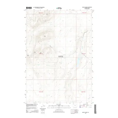
2015 Map of Mount Holmes
USGS Topo · Published 2015About this map
Mt Holmes and the high ridges of the Gallatin Range dominate this portion of northwestern Yellowstone National Park. This 2015 survey reveals a wilderness landscape defined by geothermal activity and significant topographic relief, where the Riverside Geyser sits along the drainage of Winter Cr. The map documents a network of backcountry routes, including the Trillobite Lake Trail and the Mount Holmes Winter Creek Trail, which provide access to the area's prominent peaks. High-elevation features like Trilobite Point, Antler Peak, and White Peaks create a complex watershed that feeds several watercourses, most notably Indian Cr and Straight Cr. In the eastern section, the Grizzly Lake Trail leads to the secluded waters of Grizzly Lake, illustrating the quiet, non-motorized character of this protected interior.
Find a feature on this map
21 named features on this map. Tap any name to fly to it.
Don’t see what you’re looking for? This feature index may not catch every label — zoom into the map to look around manually.
Map Details
Editions of this 2015 Mount Holmes Map
This is the sole edition of this map. No revisions or reprints were ever made.
Other maps of this area

1885 · Gallatin
USGS Topo · 1:125,000

1885 · Gallatin
USGS Topo · 1:125,000

1901 · Gallatin
USGS Topo · 1:125,000

1908 · Gallatin
USGS Topo · 1:125,000

1911 · Gallatin
USGS Topo · 1:125,000

1955 · Ashton
USGS Topo · 1:250,000

1958 · Ashton
USGS Topo · 1:250,000

1958 · Madison Junction
USGS Topo · 1:62,500

1958 · Mount Holmes
USGS Topo · 1:62,500
1958 · Norris Junction
USGS Topo · 1:62,500