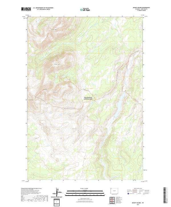
2021 Map of Mount Holmes
USGS Topo · Published 2021About this map
Yellowstone National Park reveals a landscape defined by high-elevation peaks and active geothermal features in this corner of Park County. The topography is anchored by the prominent Mt Holmes and the nearby Trilobite Point, with the thermal activity of Riverside Geyser situated along Winter Creek. This area remains largely defined by its backcountry access, as a network of designated paths including the Mount Holmes-Winter Creek Trail and the Grizzly Lake Trail provide the primary means of navigating the drainages of Indian Creek and Straight Creek. The presence of landmarks like Dome Mountain and Antler Peak suggests a terrain that has long challenged and rewarded those venturing into these protected lands, with the map recording the precise location of these geological features and the waterways that flow from their slopes.
Find a feature on this map
20 named features on this map. Tap any name to fly to it.
Don’t see what you’re looking for? This feature index may not catch every label — zoom into the map to look around manually.
Map Details
Editions of this 2021 Mount Holmes Map
This is the sole edition of this map. No revisions or reprints were ever made.
Other maps of this area

1885 · Gallatin
USGS Topo · 1:125,000

1885 · Gallatin
USGS Topo · 1:125,000

1901 · Gallatin
USGS Topo · 1:125,000

1908 · Gallatin
USGS Topo · 1:125,000

1911 · Gallatin
USGS Topo · 1:125,000

1955 · Ashton
USGS Topo · 1:250,000

1958 · Ashton
USGS Topo · 1:250,000

1958 · Madison Junction
USGS Topo · 1:62,500

1958 · Mount Holmes
USGS Topo · 1:62,500
1958 · Norris Junction
USGS Topo · 1:62,500