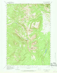
1958 Map of Mount Holmes
USGS Topo · Published 1969About this map
Mount Holmes dominates this high-altitude section of northwestern Yellowstone National Park, standing as a prominent landmark at the headwaters of several drainages. This late-1950s survey captures the intricate trail network essential for park management and backcountry travel before modern infrastructure reached these interior peaks. The presence of the Patrol Cabin near Fawn Pass highlights the era’s reliance on permanent outposts for ranger surveillance and winter patrols.
Find a feature on this map
45 named features on this map. Tap any name to fly to it.
Don’t see what you’re looking for? This feature index may not catch every label — zoom into the map to look around manually.
Map Details
Editions of this 1958 Mount Holmes Map
3 editions found

Other maps of this area

1885 · Gallatin
USGS Topo · 1:125,000

1885 · Gallatin
USGS Topo · 1:125,000

1888 · Three Forks
USGS Topo · 1:250,000

1891 · Livingston
USGS Topo · 1:250,000

1893 · Livingston
USGS Topo · 1:250,000

1894 · Three Forks
USGS Topo · 1:250,000

1895 · Three Forks
USGS Topo · 1:250,000

1901 · Gallatin
USGS Topo · 1:125,000

1908 · Gallatin
USGS Topo · 1:125,000

1911 · Gallatin
USGS Topo · 1:125,000