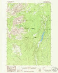
1986 Map of Mount Holmes
USGS Topo · Published 1986About this map
Yellowstone National Park dominates this mid-1980s topographic study, revealing a landscape defined by high peaks and high-altitude water systems. The western portion of the map is anchored by the prominent elevations of Mount Holmes and the White Peaks, while Antler Peak and Dome Mountain rise to the north. These summits drain into a network of alpine basins, most notably containing Trilobite Lake and the long, narrow reach of Grizzly Lake.
Find a feature on this map
12 named features on this map. Tap any name to fly to it.
Don’t see what you’re looking for? This feature index may not catch every label — zoom into the map to look around manually.
Map Details
Editions of this 1986 Mount Holmes Map
This is the sole edition of this map. No revisions or reprints were ever made.
Other maps of this area

1885 · Gallatin
USGS Topo · 1:125,000

1885 · Gallatin
USGS Topo · 1:125,000

1901 · Gallatin
USGS Topo · 1:125,000

1908 · Gallatin
USGS Topo · 1:125,000

1911 · Gallatin
USGS Topo · 1:125,000

1955 · Ashton
USGS Topo · 1:250,000

1958 · Ashton
USGS Topo · 1:250,000

1958 · Madison Junction
USGS Topo · 1:62,500

1958 · Mount Holmes
USGS Topo · 1:62,500
1958 · Norris Junction
USGS Topo · 1:62,500