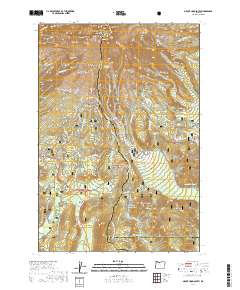
2020 Map of Mount Hood South
USGS Topo · Published 2020About this map
Mt Hood dominates the northern edge of this survey, its high-altitude geology revealed through labels like Steel Cliff, Crater Rock, and the Devils Kitchen fumarole area. The landscape drops steeply into glacier-carved features such as Zigzag Canyon and Mississippi Head, feeding a network of protected waterways including the Sandy Wild and Scenic River and the Zig Zag Wild and Scenic River.
Find a feature on this map
101 named features on this map. Tap any name to fly to it.
Don’t see what you’re looking for? This feature index may not catch every label — zoom into the map to look around manually.
Map Details
Editions of this 2020 Mount Hood South Map
This is the sole edition of this map. No revisions or reprints were ever made.
Other maps of this area

1924 · Mount Hood
USGS Topo · 1:125,000

1927 · Mount Hood
USGS Topo · 1:125,000

1953 · The Dalles
USGS Topo · 1:250,000

1956 · The Dalles
USGS Topo · 1:250,000

1956 · High Rock
USGS Topo · 1:62,500

1956 · Mt. Wilson
USGS Topo · 1:62,500

1957 · The Dalles
USGS Topo · 1:250,000

1962 · Cathedral Ridge
USGS Topo · 1:24,000
1962 · Badger Lake
USGS Topo · 1:24,000
1962 · Government Camp
USGS Topo · 1:24,000