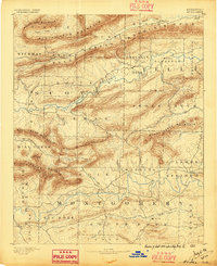
1890 Map of Mount Ida
USGS Topo · Published 1896About this map
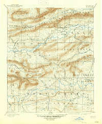
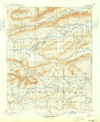
The Washita or Ouachita River flows through a landscape defined by sharp mountain ridges and isolated settlements in this late nineteenth-century survey of West Central Arkansas. The settlement of Mt Ida serves as a focal point in the south, while the mining interest at Silver City and the therapeutic draw of Sulphur Springs suggest the varied economic drivers of the era. The terrain is dominated by a series of parallel east-west ridges, including Petit Jean Mountain and Dutch Creek Mountain, which constrained travel to narrow valley corridors like those along Dutch Creek. Local geography is deeply tied to these drainage basins, with the Fourche La Fave River carving its way through the center of the sheet. For those tracing regional history, the map preserves the locations of early post offices and hamlets such as Olio, Parks, and Gravelly Hill before the modern infrastructure of the twentieth century altered the rural network.
Find a feature on this map
57 named features on this map. Tap any name to fly to it.
Don’t see what you’re looking for? This feature index may not catch every label — zoom into the map to look around manually.
Map Details
Editions of this 1890 Mount Ida Map
7 editions found
Other maps of this area

1879 · Poteau Mountain
USGS Topo · 1:62,500

1879 · Mountain Home
USGS Topo · 1:62,500

1887 · Poteau Mountain #1
USGS Topo · 1:62,500

1887 · Magazine Mountain #4
USGS Topo · 1:62,500

1887 · Mount Ida #2
USGS Topo · 1:62,500

1887 · Magazine Mountain #3
USGS Topo · 1:62,500

1887 · Magazine Mountain
USGS Topo · 1:62,500

1888 · Dardanelle #3
USGS Topo · 1:62,500

1890 · Magazine Mountain
USGS Topo · 1:125,000

1890 · Mount Ida
USGS Topo · 1:125,000