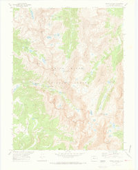
1970 Map of Mount Jackson
USGS Topo · Published 1973About this map
Mount Jackson towers over a high alpine landscape within the White River National Forest, where late-twentieth-century surveys recorded an intricate network of glacial lakes and high peaks. The terrain is defined by dramatic ridgelines such as Holy Cross Ridge and the Gold Dust Basin, reflecting a wilderness accessible primarily via the Pack Trail system. Significant water features like Mystic Island Lake, Treasure Vault Lake, and Lake Charles dot the high elevations, feeding into drainage systems like Cross Creek and Halfmoon Creek.
Find a feature on this map
49 named features on this map. Tap any name to fly to it.
Don’t see what you’re looking for? This feature index may not catch every label — zoom into the map to look around manually.
Map Details
Editions of this 1970 Mount Jackson Map
3 editions found
Other maps of this area

1889 · Leadville
USGS Topo · 1:125,000

1891 · Leadville
USGS Topo · 1:125,000

1909 · Mount Jackson
USGS Topo · 1:125,000

1911 · Mount Jackson
USGS Topo · 1:125,000

1934 · Minturn
USGS Topo · 1:62,500

1942 · Leadville
USGS Topo · 1:125,000

1949 · Holy Cross
USGS Topo · 1:62,500

1950 · Minturn
USGS Topo · 1:62,500

1951 · Holy Cross
USGS Topo · 1:62,500

1957 · Leadville
USGS Topo · 1:250,000