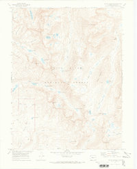
1970 Map of Mount Jackson
USGS Topo · Published 1973About this map
Mount Jackson and the dramatic Holy Cross Ridge dominate this high-altitude landscape within the White River National Forest during the early 1970s. The map captures a complex alpine environment defined by its numerous glacial water bodies, from the remote Mystic Island Lake and New York Lake in the north to the Missouri Lakes and Josephine Lake near the southern boundary. The topography reveals a network of drainages including Gold Dust Creek, Halfmoon Creek, and West Lake Creek that carve through the peaks.
Find a feature on this map
55 named features on this map. Tap any name to fly to it.
Don’t see what you’re looking for? This feature index may not catch every label — zoom into the map to look around manually.
Map Details
Editions of this 1970 Mount Jackson Map
3 editions found
Other maps of this area

1889 · Leadville
USGS Topo · 1:125,000

1891 · Leadville
USGS Topo · 1:125,000

1909 · Mount Jackson
USGS Topo · 1:125,000

1911 · Mount Jackson
USGS Topo · 1:125,000

1934 · Minturn
USGS Topo · 1:62,500

1942 · Leadville
USGS Topo · 1:125,000

1949 · Holy Cross
USGS Topo · 1:62,500

1950 · Minturn
USGS Topo · 1:62,500

1951 · Holy Cross
USGS Topo · 1:62,500

1957 · Leadville
USGS Topo · 1:250,000