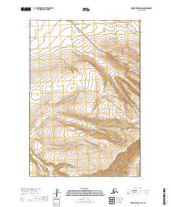
2019 Map of Mount Katmai A-6 SW
USGS Topo · Published 2019About this map
Katmai National Park and the Becharof National Wildlife Refuge meet in this 2019 survey, defining a landscape of high-elevation glacial and volcanic terrain in the Lake and Peninsula Borough. The topography is characterized by steep contour gradients that mark the transition between these two massive protected areas. The only named waterway flowing through this high country is Gertrude Cr, which winds through the western portion of the map. This study highlights the strict administrative boundaries that separate these federal lands, providing a precise record of the terrain as it appeared in the early twenty-first century. The absence of roads or human settlements underscores the wilderness character of the Alaska Peninsula in this region.
Find a feature on this map
7 named features on this map. Tap any name to fly to it.
Don’t see what you’re looking for? This feature index may not catch every label — zoom into the map to look around manually.
Map Details
Editions of this 2019 Mount Katmai A-6 SW Map
This is the sole edition of this map. No revisions or reprints were ever made.
Other maps of this area

1943 · Ugashik
USGS Topo · 1:250,000

1948 · Mt Katmai
USGS Topo · 1:250,000

1948 · Ugashik
USGS Topo · 1:250,000

1949 · Ugashik
USGS Topo · 1:250,000

1951 · Mt Katmai
USGS Topo · 1:250,000

1951 · Karluk
USGS Topo · 1:250,000

1951 · Mount Katmai A-6
USGS Topo · 1:63,360

1951 · Ugashik D-1
USGS Topo · 1:63,360

1951 · Karluk D-6
USGS Topo · 1:63,360

1951 · Naknek A-1
USGS Topo · 1:63,360