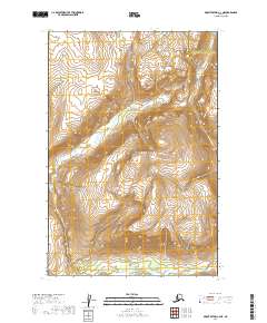
2019 Map of Mount Katmai C-3 NE
USGS Topo · Published 2019About this map
Katmai National Park encompasses the majority of this landscape, showcasing a vast interior of high-elevation terrain and glacial drainages. The map highlights the jurisdictional boundary of the Kenai Peninsula Borough Lake and Peninsula Borough, cutting through the northeastern portion of the sheet. This area is defined by its dramatic relief, where deep valleys are carved by watercourses like Hardscrabble Cr and Gorge Cr. The intricate contour intervals illustrate the extreme verticality of the peaks and ridges, providing a clear picture of the hydrological patterns and topographic barriers that shape this remote part of Alaska before it reaches the coast.
Find a feature on this map
10 named features on this map. Tap any name to fly to it.
Don’t see what you’re looking for? This feature index may not catch every label — zoom into the map to look around manually.
Map Details
Editions of this 2019 Mount Katmai C-3 NE Map
This is the sole edition of this map. No revisions or reprints were ever made.
Other maps of this area

1948 · Mt Katmai
USGS Topo · 1:250,000

1951 · Mt Katmai
USGS Topo · 1:250,000

1951 · Mount Katmai C-3
USGS Topo · 1:63,360

1951 · Mount Katmai C-2
USGS Topo · 1:63,360

1951 · Mount Katmai D-2
USGS Topo · 1:63,360

1951 · Mount Katmai D-3
USGS Topo · 1:63,360
1953 · Mount Katmai C-2
USGS Topo · 1:63,360

1964 · Mt. Katmai
USGS Topo · 1:250,000
2019 · Mount Katmai C-2 NW
USGS Topo · 1:25,000
2019 · Mount Katmai C-2 SW
USGS Topo · 1:25,000