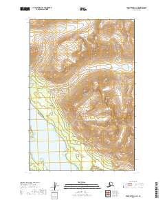
2019 Map of Mount Katmai C-4 NE
USGS Topo · Published 2019About this map
Katmai National Park preserves a remote stretch of the Alaska Peninsula where the landscape is defined by steep glacial valleys and tectonic activity. The northern reaches of Lake Grosvenor extend into the southwestern corner of this sheet, serving as a prominent landmark in an otherwise unpopulated mountain wilderness. This 2019 survey documents the intricate topographic contours and hydrologic drainage patterns that characterize the region's high-elevation terrain. Located within the Lake and Peninsula Borough, this area remains largely inaccessible by road, with the map showing the raw natural state of the land as managed by the National Park Service. The lack of man-made structures or named settlements highlights the preserved, undeveloped character of this protected ecosystem.
Find a feature on this map
8 named features on this map. Tap any name to fly to it.
Don’t see what you’re looking for? This feature index may not catch every label — zoom into the map to look around manually.
Map Details
Editions of this 2019 Mount Katmai C-4 NE Map
This is the sole edition of this map. No revisions or reprints were ever made.
Other maps of this area

1948 · Mt Katmai
USGS Topo · 1:250,000

1951 · Mt Katmai
USGS Topo · 1:250,000

1951 · Mount Katmai C-3
USGS Topo · 1:63,360

1951 · Mount Katmai C-4
USGS Topo · 1:63,360

1951 · Mount Katmai D-4
USGS Topo · 1:63,360

1951 · Mount Katmai D-3
USGS Topo · 1:63,360

1964 · Mt. Katmai
USGS Topo · 1:250,000
2019 · Mount Katmai C-4 SW
USGS Topo · 1:25,000
2019 · Mount Katmai C-4 SE
USGS Topo · 1:25,000
2019 · Mount Katmai C-3 NW
USGS Topo · 1:25,000