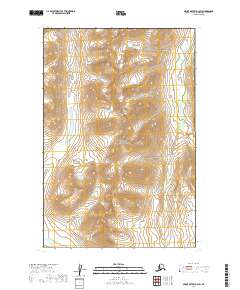
2019 Map of Mount Katmai D-3 SW
USGS Topo · Published 2019About this map
Katmai National Park encompasses the majority of this landscape, reflecting a protected wilderness defined by extreme elevation changes and glacial-carved drainage systems. In the southwestern corner, the headwaters of American Cr emerge from the high ridges, carving a narrow valley floor amidst a series of unnamed peaks and ridges that rise several thousand feet above sea level. This survey illustrates the intricate township and range divisions, such as t15s r34w and t16s r34w, which overlay the terrain in a strictly mathematical grid despite the complex topography of the Alaska Peninsula. The lack of man-made infrastructure or named settlements emphasizes the character of the region as a preserved natural corridor, where the land is primarily organized by survey benchmarks and natural watersheds.
Find a feature on this map
6 named features on this map. Tap any name to fly to it.
Don’t see what you’re looking for? This feature index may not catch every label — zoom into the map to look around manually.
Map Details
Editions of this 2019 Mount Katmai D-3 SW Map
This is the sole edition of this map. No revisions or reprints were ever made.
Other maps of this area

1948 · Mt Katmai
USGS Topo · 1:250,000

1951 · Mt Katmai
USGS Topo · 1:250,000

1951 · Mount Katmai C-3
USGS Topo · 1:63,360

1951 · Mount Katmai C-4
USGS Topo · 1:63,360

1951 · Mount Katmai D-4
USGS Topo · 1:63,360

1951 · Mount Katmai D-3
USGS Topo · 1:63,360

1964 · Mt. Katmai
USGS Topo · 1:250,000
2019 · Mount Katmai D-3 NE
USGS Topo · 1:25,000
2019 · Mount Katmai C-3 NW
USGS Topo · 1:25,000
2019 · Mount Katmai D-3 SE
USGS Topo · 1:25,000