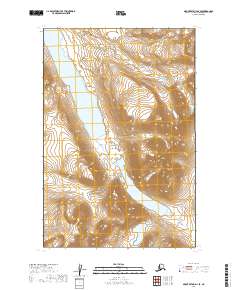
2019 Map of Mount Katmai D-4 SE
USGS Topo · Published 2019About this map
Katmai National Park defines this landscape in the Lake and Peninsula Borough, characterized by significant glacial or volcanic water bodies and their connecting drainages. The central corridor of this survey is dominated by the elongated Hammersly Lake, which transitions southward toward the headwaters of American Cr. Further southeast, Murray Lake sits within a steep valley, illustrating the high-elevation hydrology typical of the Alaska Peninsula. The map is primarily a study of topography and natural boundaries, showing the township and range lines of t15s r35w and t16s r35w as they overlay this protected wilderness. With no roads or permanent human settlements recorded, the map highlights a pristine environment where American Creek serves as a primary drainage route between the major lakes.
Find a feature on this map
8 named features on this map. Tap any name to fly to it.
Don’t see what you’re looking for? This feature index may not catch every label — zoom into the map to look around manually.
Map Details
Editions of this 2019 Mount Katmai D-4 SE Map
This is the sole edition of this map. No revisions or reprints were ever made.
Other maps of this area

1948 · Mt Katmai
USGS Topo · 1:250,000

1951 · Mt Katmai
USGS Topo · 1:250,000

1951 · Mount Katmai C-3
USGS Topo · 1:63,360

1951 · Mount Katmai C-4
USGS Topo · 1:63,360

1951 · Mount Katmai D-4
USGS Topo · 1:63,360

1951 · Mount Katmai D-3
USGS Topo · 1:63,360

1964 · Mt. Katmai
USGS Topo · 1:250,000
2019 · Mount Katmai D-4 NW
USGS Topo · 1:25,000
2019 · Mount Katmai C-3 NW
USGS Topo · 1:25,000
2019 · Mount Katmai C-4 NW
USGS Topo · 1:25,000