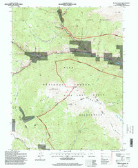
1994 Map of Mount Logan
USGS Topo · Published 1998About this map
The North Fork South Platte River carves a central corridor through this section of the Rocky Mountains, where the small settlements of Webster, Grant, and Santa Maria follow the river valley's natural course. This 1990s revision reflects a landscape shaped by both early mining and modern infrastructure, including the Harold Roberts Tunnel and an Air Shaft near Guanella Pass Scenic Byway. Local genealogy and land use are anchored by sites like Lamping Cem and the extensive boundaries of the Pike National Forest.
Find a feature on this map
40 named features on this map. Tap any name to fly to it.
Don’t see what you’re looking for? This feature index may not catch every label — zoom into the map to look around manually.
Map Details
Editions of this 1994 Mount Logan Map
This is the sole edition of this map. No revisions or reprints were ever made.
Other maps of this area

1903 · Georgetown
USGS Topo · 1:62,500

1905 · Georgetown
USGS Topo · 1:62,500

1924 · Montezuma
USGS Topo · 1:62,500

1926 · Montezuma
USGS Topo · 1:62,500

1933 · Montezuma
USGS Topo · 1:62,500

1937 · Como
USGS Topo · 1:62,500

1945 · Shawnee
USGS Topo · 1:24,000

1945 · Mount Logan
USGS Topo · 1:24,000

1948 · Mount Logan
USGS Topo · 1:24,000

1948 · Shawnee
USGS Topo · 1:24,000