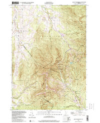
1997 Map of Mount Mansfield
USGS Topo · Published 2000About this map
Mount Mansfield and the Sterling Range dominate this landscape, illustrating the late-20th-century character of Vermont's high-country recreation and rural mountain life. The map details the rugged corridor of Smugglers Notch, flanked by distinctive landmarks like Old Smugglers Face, Bear Head, and Elephants Head. The summit ridgeline is intricately charted from The Forehead to The Chin, including high-altitude features like Lake of the Clouds and Adams Apple.
Find a feature on this map
54 named features on this map. Tap any name to fly to it.
Don’t see what you’re looking for? This feature index may not catch every label — zoom into the map to look around manually.
Map Details
Editions of this 1997 Mount Mansfield Map
This is the sole edition of this map. No revisions or reprints were ever made.
Other maps of this area

1919 · Montpelier
USGS Topo · 1:62,500

1921 · Richmond
USGS Topo · 1:48,000

1921 · Montpelier
USGS Topo · 1:62,500

1924 · Camels Hump
USGS Topo · 1:62,500

1925 · Mount Mansfield
USGS Topo · 1:48,000

1927 · Mount Mansfield
USGS Topo · 1:62,500

1927 · Hyde Park
USGS Topo · 1:48,000

1930 · Hyde Park
USGS Topo · 1:62,500
1943 · Hyde Park
USGS Topo · 1:62,500

1944 · Montpelier
USGS Topo · 1:62,500