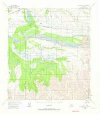
1954 Map of Mount McKinley B-2
USGS Topo · Published 1974About this map
Wonder Lake and the wide, braided course of the Mc Kinley River dominate this interior Alaskan landscape during the mid-1950s. The survey captures the wilderness infrastructure of the era, including the Mc Kinley Park Road as it winds toward the north, passing a campground and a remote Ranger Station near the lake's northern tip. The terrain transitions from the alluvial fans of Mc Kinley Bar to the high-altitude ice of the Muldrow Glacier in the southeast corner.
Find a feature on this map
20 named features on this map. Tap any name to fly to it.
Don’t see what you’re looking for? This feature index may not catch every label — zoom into the map to look around manually.
Map Details
Editions of this 1954 Mount McKinley B-2 Map
3 editions found

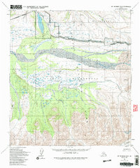
Other maps of this area

1952 · Mount McKinley
USGS Topo · 1:250,000

1952 · Mount McKinley B-2
USGS Topo · 1:63,360

1952 · Mount McKinley C-3
USGS Topo · 1:63,360

1952 · Mount McKinley B-1
USGS Topo · 1:63,360

1952 · Mount McKinley C-1
USGS Topo · 1:63,360

1952 · Mount McKinley C-2
USGS Topo · 1:63,360

1953 · Mount McKinley B-3
USGS Topo · 1:63,360

1954 · Mount McKinley C-1
USGS Topo · 1:63,360

1954 · Mount McKinley B-1
USGS Topo · 1:63,360

1954 · Mount McKinley B-3
USGS Topo · 1:63,360