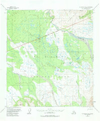
1954 Map of Mount McKinley B-3
USGS Topo · Published 1984About this map
The Mount McKinley National Park Boundary bisects this landscape, separating the protected wilderness from the active industrial and geographic features of the Kantishna Hills. In the northeast, the Antimony Mine stands as a primary site of interest, connected to the broader region by the Slate Tractor Trail. This trail underscores the logistical challenges of resource extraction in the Alaskan interior during the mid-20th century.
Find a feature on this map
17 named features on this map. Tap any name to fly to it.
Don’t see what you’re looking for? This feature index may not catch every label — zoom into the map to look around manually.
Map Details
Editions of this 1954 Mount McKinley B-3 Map
5 editions found

Other maps of this area

1952 · Mount McKinley
USGS Topo · 1:250,000

1952 · Mount McKinley B-2
USGS Topo · 1:63,360

1952 · Mount McKinley C-3
USGS Topo · 1:63,360

1952 · Mount McKinley C-2
USGS Topo · 1:63,360

1953 · Mount McKinley B-4
USGS Topo · 1:63,360

1953 · Mount McKinley B-3
USGS Topo · 1:63,360

1953 · Mount McKinley C-4
USGS Topo · 1:63,360

1953 · Mount McKinley A-4
USGS Topo · 1:63,360

1954 · Mount McKinley C-4
USGS Topo · 1:63,360

1954 · Mount McKinley A-4
USGS Topo · 1:63,360