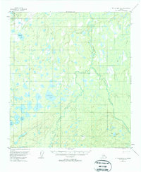
1953 Map of Mount McKinley C-5
USGS Topo · Published 1963About this map
Glacial drainage and intricate wetlands define this subarctic landscape in the mid-twentieth century. The Foraker River and Herron River dominate the drainage pattern, meandering through a labyrinth of unnamed ponds and marshes characteristic of the interior Alaskan tundra. Evidence of human presence is sparse but specific, noted by a single Cabin near the eastern riverbank and the descriptive Old Cache Lake, suggesting a history of seasonal trapping or subsistence use.
Find a feature on this map
15 named features on this map. Tap any name to fly to it.
Don’t see what you’re looking for? This feature index may not catch every label — zoom into the map to look around manually.
Map Details
Editions of this 1953 Mount McKinley C-5 Map
2 editions found
Other maps of this area

1952 · Mount McKinley
USGS Topo · 1:250,000

1953 · Mount McKinley C-5
USGS Topo · 1:63,360

1953 · Mount McKinley B-4
USGS Topo · 1:63,360

1953 · Mount McKinley B-5
USGS Topo · 1:63,360

1953 · Mount McKinley D-5
USGS Topo · 1:63,360

1953 · Mount McKinley C-4
USGS Topo · 1:63,360

1953 · Mount McKinley D-4
USGS Topo · 1:63,360

1954 · Mount McKinley C-4
USGS Topo · 1:63,360

1954 · Mount McKinley D-4
USGS Topo · 1:63,360

1954 · Mount McKinley D-5
USGS Topo · 1:63,360