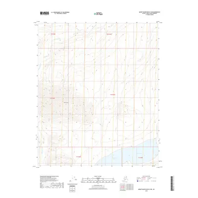
2018 Map of Mount Michelson B-2 NW
USGS Topo · Published 2018About this map
Okiotak Peak dominates the central terrain of this North Slope landscape, where high-altitude drainages form the headwaters of several significant Arctic water systems. To the south, the massive Lake Schrader and the Neruokpuk Lakes provide a stark contrast to the surrounding steep-contour topography. These lake systems are fed by mountain runoff from channels like Coke Cr, which eventually contributes to the larger regional river networks. The Sadlerochit River and its various tributaries, including Snow Cr and Gravel Cr, carve through the northern sections of the survey. The absence of roads or permanent structures reflects the extreme environment of the Brooks Range foothills, where the land is defined purely by its natural hydrology and the sharp relief of the mountains before they descend toward the coastal plain.
Find a feature on this map
15 named features on this map. Tap any name to fly to it.
Don’t see what you’re looking for? This feature index may not catch every label — zoom into the map to look around manually.
Map Details
Editions of this 2018 Mount Michelson B-2 NW Map
This is the sole edition of this map. No revisions or reprints were ever made.
Other maps of this area

1951 · Mt. Michelson
USGS Topo · 1:250,000

1955 · Mount Michelson C-3
USGS Topo · 1:63,360

1955 · Mount Michelson C-2
USGS Topo · 1:63,360

1956 · Mt. Michelson
USGS Topo · 1:250,000

1956 · Mount Michelson B-2
USGS Topo · 1:63,360

1956 · Mount Michelson B-3
USGS Topo · 1:63,360

1975 · Mount Michelson C-3
USGS Topo · 1:63,360
2018 · Mount Michelson B-2 SE
USGS Topo · 1:25,000
2018 · Mount Michelson C-3 SE
USGS Topo · 1:25,000
2018 · Mount Michelson B-2 SW
USGS Topo · 1:25,000