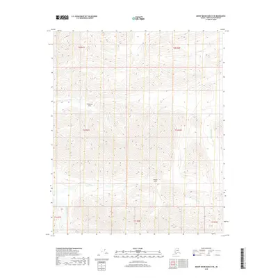
2018 Map of Mount Michelson B-3 NE
USGS Topo · Published 2018About this map
The Sadlerochit River defines the eastern reach of this high-latitude terrain, where steep mountain drainage systems carve a complex network of valleys. The geography is centered around the massive Ikiakpaurak Valley and the Ikiakpuk Valley, landforms that reflect the glacial and hydrological history of the North Slope. These valleys serve as natural corridors between the surrounding peaks, funneled by seasonal watercourses like Fire Cr, Talus Cr, and Eagle Creek. This 2018 survey by the U.S. Geological Survey illustrates the stark, unpopulated character of the Arctic wilderness, emphasizing the intricate contour lines of the Brooks Range foothills rather than human settlement. The drainage patterns of Cache Creek and Snow Cr provide a look at the watershed's role in shaping the northern Alaskan interior.
Find a feature on this map
17 named features on this map. Tap any name to fly to it.
Don’t see what you’re looking for? This feature index may not catch every label — zoom into the map to look around manually.
Map Details
Editions of this 2018 Mount Michelson B-3 NE Map
This is the sole edition of this map. No revisions or reprints were ever made.
Other maps of this area

1951 · Mt. Michelson
USGS Topo · 1:250,000

1955 · Mount Michelson C-3
USGS Topo · 1:63,360

1955 · Mount Michelson C-2
USGS Topo · 1:63,360

1956 · Mt. Michelson
USGS Topo · 1:250,000

1956 · Mount Michelson B-2
USGS Topo · 1:63,360

1956 · Mount Michelson B-3
USGS Topo · 1:63,360

1975 · Mount Michelson C-3
USGS Topo · 1:63,360
2018 · Mount Michelson C-3 SE
USGS Topo · 1:25,000
2018 · Mount Michelson B-2 SW
USGS Topo · 1:25,000
2018 · Mount Michelson C-2 SW
USGS Topo · 1:25,000