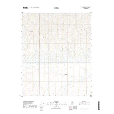
2018 Map of Mount Michelson C-2 SW
USGS Topo · Published 2018About this map
The Sadlerochit River winds through this northern landscape, marking a significant drainage path in the North Slope Borough. This high-latitude environment is characterized by a dense network of watercourses, including the Nularvik River and several specifically named tributaries like Black Dog Cr and Limit Cr. The hydrology here indicates a complex permafrost-influenced terrain where seasonal meltwater flows across the tundra. Notable smaller features such as Camp 263 Cr and Fossil Cr provide specific points of reference for research and mapping in an area defined by its hydrology rather than permanent settlements. The map also delineates township boundaries, including t3n r28e and t2n r29e, which provide a formal grid over this remote territory.
Find a feature on this map
14 named features on this map. Tap any name to fly to it.
Don’t see what you’re looking for? This feature index may not catch every label — zoom into the map to look around manually.
Map Details
Editions of this 2018 Mount Michelson C-2 SW Map
This is the sole edition of this map. No revisions or reprints were ever made.
Other maps of this area

1951 · Mt. Michelson
USGS Topo · 1:250,000

1955 · Mount Michelson C-3
USGS Topo · 1:63,360

1955 · Mount Michelson C-2
USGS Topo · 1:63,360

1956 · Mt. Michelson
USGS Topo · 1:250,000

1956 · Mount Michelson B-2
USGS Topo · 1:63,360

1956 · Mount Michelson B-3
USGS Topo · 1:63,360

1975 · Mount Michelson C-3
USGS Topo · 1:63,360
2018 · Mount Michelson C-3 SE
USGS Topo · 1:25,000
2018 · Mount Michelson C-2 NW
USGS Topo · 1:25,000
2018 · Mount Michelson B-2 NE
USGS Topo · 1:25,000