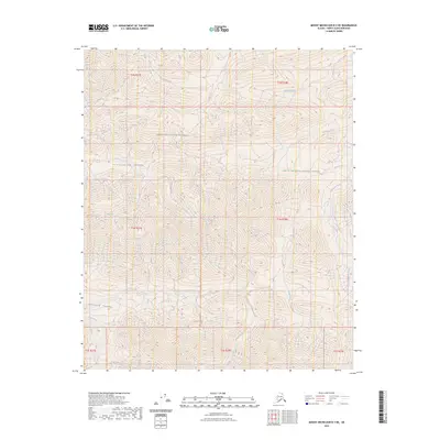
2023 Map of Mount Michelson B-3 NE
USGS Topo · Published 2023About this map
Mollie Beattie Wilderness and the Arctic National Wildlife Refuge converge in this northern Alaskan landscape, where the Sadlerochit River flows through the eastern reach. The terrain is defined by dramatic glacial features, including the Kiakpaurak Valley and Ikiakpuk Valley, which reveal a complex system of drainage from the surrounding peaks. A network of alpine waterways, such as Fire Creek, Gravel Creek, and Snow Creek, carve through the high elevations before joining the larger river system. The presence of Cache Creek and Talus Creek highlights the specialized mountain geography that dominates this protected wilderness area. This modern survey provides a precise look at the uninhabited backcountry of the North Slope, documenting the drainage patterns of Eagle Creek as they existed in the early twenty-first century.
Find a feature on this map
19 named features on this map. Tap any name to fly to it.
Don’t see what you’re looking for? This feature index may not catch every label — zoom into the map to look around manually.
Map Details
Editions of this 2023 Mount Michelson B-3 NE Map
This is the sole edition of this map. No revisions or reprints were ever made.
Other maps of this area

1951 · Mt. Michelson
USGS Topo · 1:250,000

1955 · Mount Michelson C-3
USGS Topo · 1:63,360

1955 · Mount Michelson C-2
USGS Topo · 1:63,360

1956 · Mt. Michelson
USGS Topo · 1:250,000

1956 · Mount Michelson B-2
USGS Topo · 1:63,360

1956 · Mount Michelson B-3
USGS Topo · 1:63,360

1975 · Mount Michelson C-3
USGS Topo · 1:63,360
2018 · Mount Michelson C-3 SE
USGS Topo · 1:25,000
2018 · Mount Michelson B-2 SW
USGS Topo · 1:25,000
2018 · Mount Michelson C-2 SW
USGS Topo · 1:25,000