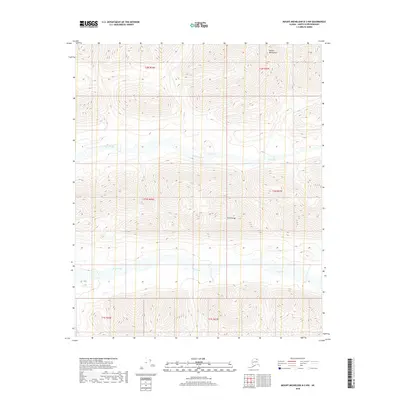
2018 Map of Mount Michelson B-3 NW
USGS Topo · Published 2018About this map
Shublik Mountain rises in the northern reaches of this Arctic terrain, where the northernmost ridges of the Brooks Range meet the North Slope. The landscape is defined by the east-west orientation of parallel watercourses and mountain folds, with Cache Creek and Eagle Creek carving valleys through the structural lines of the Third Range. This 2018 survey documents the precise topography of the North Slope Borough, illustrating the intricate drainage patterns that flow from these high ridges. The absence of roads or permanent structures reflects the wilderness character of this remote Alaskan environment, which remains largely defined by the natural boundaries of townships like t2n r26e and t1s r27e.
Find a feature on this map
10 named features on this map. Tap any name to fly to it.
Don’t see what you’re looking for? This feature index may not catch every label — zoom into the map to look around manually.
Map Details
Editions of this 2018 Mount Michelson B-3 NW Map
This is the sole edition of this map. No revisions or reprints were ever made.
Other maps of this area

1951 · Mt. Michelson
USGS Topo · 1:250,000

1955 · Mount Michelson C-3
USGS Topo · 1:63,360

1955 · Mount Michelson C-4
USGS Topo · 1:63,360

1956 · Mt. Michelson
USGS Topo · 1:250,000

1956 · Mount Michelson B-3
USGS Topo · 1:63,360

1975 · Mount Michelson C-3
USGS Topo · 1:63,360

1978 · Mount Michelson C-4
USGS Topo · 1:63,360
1983 · Mount Michelson B-4
USGS Topo · 1:63,360
2018 · Mount Michelson B-4 NE
USGS Topo · 1:25,000
2018 · Mount Michelson C-3 SE
USGS Topo · 1:25,000