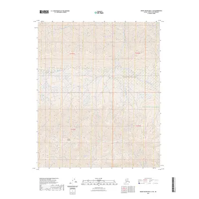
2023 Map of Mount Michelson C-3 SW
USGS Topo · Published 2023About this map
Ignek Valley serves as a prominent natural corridor between the northern slopes and the Shublik Mountains to the south. This 2023 survey by the U.S. Geological Survey illustrates a landscape defined by significant drainage networks, where Ignek Creek and Nanook Creek thread through the valley floor. The map highlights the intersection of protected lands, specifically the Mollie Beattie Wilderness and the broader Arctic National Wildlife Refuge. The complex hydrology is anchored by the Tamayariak River in the north and the Katakturuk River to the east. These watercourses and mountain ranges reflect the remote, high-latitude topography of the North Slope, documented here with modern elevation data and Public Land Survey System township markers.
Find a feature on this map
12 named features on this map. Tap any name to fly to it.
Don’t see what you’re looking for? This feature index may not catch every label — zoom into the map to look around manually.
Map Details
Editions of this 2023 Mount Michelson C-3 SW Map
This is the sole edition of this map. No revisions or reprints were ever made.
Other maps of this area

1951 · Mt. Michelson
USGS Topo · 1:250,000

1955 · Mount Michelson C-3
USGS Topo · 1:63,360

1955 · Mount Michelson C-4
USGS Topo · 1:63,360

1956 · Mt. Michelson
USGS Topo · 1:250,000

1956 · Mount Michelson B-3
USGS Topo · 1:63,360

1975 · Mount Michelson C-3
USGS Topo · 1:63,360

1978 · Mount Michelson C-4
USGS Topo · 1:63,360
1983 · Mount Michelson B-4
USGS Topo · 1:63,360
2018 · Mount Michelson B-4 NE
USGS Topo · 1:25,000
2018 · Mount Michelson C-3 SE
USGS Topo · 1:25,000