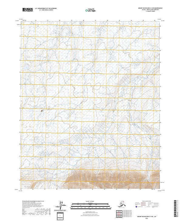
2024 Map of Mount Michelson C-4 NE
USGS Topo · Published 2024About this map
The Arctic National Wildlife Refuge defines this portion of the Alaska North Slope, where the landscape transitions from wet coastal tundra to the rising elevations of the Brooks Range foothills. The Mollie Beattie Wilderness spans much of the central and southern sections of the map, protecting a vast roadless area characterized by complex braided drainage patterns. The Tamayariak River winds through the eastern side of the quadrangle, serving as a primary hydrological feature in an environment dominated by seasonal wetlands and small lakes. In the southwest, Red Hill provides a distinct topographic landmark amidst the lower-lying terrain. This 2024 survey documents a region defined by its lack of permanent settlements and industrial infrastructure, preserving the natural state of the northern wilderness.
Find a feature on this map
10 named features on this map. Tap any name to fly to it.
Don’t see what you’re looking for? This feature index may not catch every label — zoom into the map to look around manually.
Map Details
Editions of this 2024 Mount Michelson C-4 NE Map
This is the sole edition of this map. No revisions or reprints were ever made.
Other maps of this area

1951 · Mt. Michelson
USGS Topo · 1:250,000

1955 · Mount Michelson C-3
USGS Topo · 1:63,360

1955 · Mount Michelson D-3
USGS Topo · 1:63,360

1955 · Mount Michelson C-4
USGS Topo · 1:63,360

1955 · Mount Michelson D-4
USGS Topo · 1:63,360

1956 · Mt. Michelson
USGS Topo · 1:250,000

1975 · Mount Michelson C-3
USGS Topo · 1:63,360

1978 · Mount Michelson C-4
USGS Topo · 1:63,360
2018 · Mount Michelson C-4 SE
USGS Topo · 1:25,000
2018 · Mount Michelson C-4 NE
USGS Topo · 1:25,000