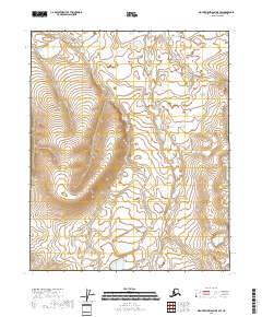
2018 Map of Mount Michelson D-5 SW
USGS Topo · Published 2018About this map
The low-lying Arctic coastal plain dominates this 2018 survey of the North Slope, revealing a landscape defined by an intricate network of wetlands and seasonal water bodies. The terrain is characterized by the repeating patterns of polygonal ground and shallow thermokarst lakes, which are typical of the permafrost-underlain tundra. This specific map focuses on a remote expanse where human infrastructure is entirely absent, providing a baseline of the natural drainage patterns and landforms before any potential development. The surveying grid identifies the administrative townships of t6n r21e, t6n r22e, t5n r21e, and t5n r22e as they cross this untouched environment. While the map is sparse in named geographic landmarks, it offers a high-resolution look at the subtle elevation changes and hydrological features that dictate the movement of water across the North Slope Borough.
Find a feature on this map
4 named features on this map. Tap any name to fly to it.
Don’t see what you’re looking for? This feature index may not catch every label — zoom into the map to look around manually.
Map Details
Editions of this 2018 Mount Michelson D-5 SW Map
This is the sole edition of this map. No revisions or reprints were ever made.
Other maps of this area

1951 · Sagavanirktok D-5
USGS Topo · 1:250,000

1951 · Mt. Michelson
USGS Topo · 1:250,000

1955 · Mount Michelson C-5
USGS Topo · 1:63,360

1955 · Mount Michelson D-5
USGS Topo · 1:63,360
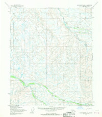
1955 · Sagavanirktok C-1
USGS Topo · 1:63,360
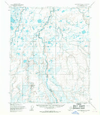
1955 · Sagavanirktok D-1
USGS Topo · 1:63,360

1956 · Mt. Michelson
USGS Topo · 1:250,000

1956 · Sagavanirktok
USGS Topo · 1:250,000

1958 · Sagavanirktok
USGS Topo · 1:250,000

1964 · Sagavanirktok
USGS Topo · 1:250,000