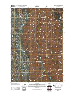
2011 Map of Mount Moriah
USGS Topo · Published 2011About this map
Mount Moriah rises above a landscape defined by its deep river canyons and intricate drainage systems in Union County. The Minam River and its tributary, the Little Minam River, serve as the primary hydrologic arteries, flanked by distinctive landforms such as Backbone Ridge and Big Sheep Ridge. This 2011 survey illustrates a wilderness interface where water sources like Chicken Spring, Rock Spring, and Moonrise Spring are critical landmarks within the forested terrain. The western portion of the map is dominated by the North Fork Clark Creek and Middle Fork Clark Creek networks, which weave around high points like Elk Point and Collusion Point. Grounded in the drainage patterns of the Wallowa region, the map shows the spatial relationship between isolated clearings like Horse Meadow and the surrounding ridgelines, including High Ridge and Mahogany Ridge.
Find a feature on this map
33 named features on this map. Tap any name to fly to it.
Don’t see what you’re looking for? This feature index may not catch every label — zoom into the map to look around manually.
Map Details
Editions of this 2011 Mount Moriah Map
This is the sole edition of this map. No revisions or reprints were ever made.
Other maps of this area

1906 · Telocaset
USGS Topo · 1:125,000

1955 · Grangeville
USGS Topo · 1:250,000

1959 · Grangeville
USGS Topo · 1:250,000

1964 · Cricket Flat
USGS Topo · 1:24,000

1964 · Wallowa
USGS Topo · 1:24,000

1964 · Minam
USGS Topo · 1:24,000

1965 · Fox Point
USGS Topo · 1:24,000

1965 · Cove
USGS Topo · 1:24,000
1965 · Gasset Bluff
USGS Topo · 1:24,000
1965 · Mount Moriah
USGS Topo · 1:24,000