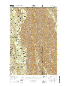
2014 Map of Mount Moriah
USGS Topo · Published 2014About this map
Whitman National Forest and Wallowa National Forest converge in this high-altitude landscape along the Union and Wallowa county line. The terrain is defined by a series of steep drainages and prominent overlooks, most notably the namesake Mount Moriah and the sheer verticality of Line Bluff. Water sources are critical markers in this environment, with names like Chicken Spring, Rock Spring, and Jim Spring indicating the importance of these points for travelers and livestock in the backcountry.
Find a feature on this map
47 named features on this map. Tap any name to fly to it.
Don’t see what you’re looking for? This feature index may not catch every label — zoom into the map to look around manually.
Map Details
Editions of this 2014 Mount Moriah Map
This is the sole edition of this map. No revisions or reprints were ever made.
Other maps of this area

1906 · Telocaset
USGS Topo · 1:125,000

1955 · Grangeville
USGS Topo · 1:250,000

1959 · Grangeville
USGS Topo · 1:250,000

1964 · Cricket Flat
USGS Topo · 1:24,000

1964 · Wallowa
USGS Topo · 1:24,000

1964 · Minam
USGS Topo · 1:24,000

1965 · Fox Point
USGS Topo · 1:24,000

1965 · Cove
USGS Topo · 1:24,000
1965 · Gasset Bluff
USGS Topo · 1:24,000
1965 · Mount Moriah
USGS Topo · 1:24,000