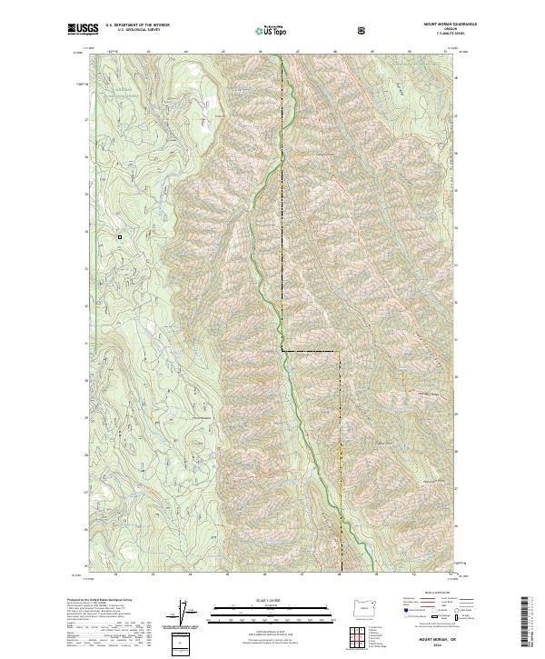
2024 Map of Mount Moriah
USGS Topo · Published 2024About this map
Minam Wild and Scenic River defines the central canyon of this high-elevation landscape, where the Minam River flows north through the heart of the Eagle Cap Wilderness. The terrain is marked by sharp topographic relief between the river floor and high summits like Mt Moriah and Monument Point. This map captures a strictly protected wilderness environment where human presence is indicated only by primitive footpaths such as the Minam River Trl and Big Sheep Ridge Trl. The boundary between Union Co and Wallowa Co follows the high drainage divides, separating the Whitman National Forest from the Wallowa National Forest. Remote landmarks like Horse Meadow and Chicken Spring serve as critical reference points for navigation through this roadless backcountry, which remains one of the most primitive reaches of the Blue Mountains region.
Find a feature on this map
53 named features on this map. Tap any name to fly to it.
Don’t see what you’re looking for? This feature index may not catch every label — zoom into the map to look around manually.
Map Details
Editions of this 2024 Mount Moriah Map
This is the sole edition of this map. No revisions or reprints were ever made.
Other maps of this area

1906 · Telocaset
USGS Topo · 1:125,000

1955 · Grangeville
USGS Topo · 1:250,000

1959 · Grangeville
USGS Topo · 1:250,000

1964 · Cricket Flat
USGS Topo · 1:24,000

1964 · Wallowa
USGS Topo · 1:24,000

1964 · Minam
USGS Topo · 1:24,000

1965 · Fox Point
USGS Topo · 1:24,000

1965 · Cove
USGS Topo · 1:24,000
1965 · Gasset Bluff
USGS Topo · 1:24,000
1965 · Mount Moriah
USGS Topo · 1:24,000