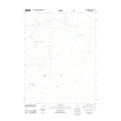
2012 Map of Mount Moriah
USGS Topo · Published 2012About this map
Mount Moriah stands as the dominant topographical feature in this high-elevation corner of White Pine County, where a complex network of drainages and springs defines the remote terrain. The eastern slopes are marked by deep incisions such as Rye Grass Canyon and Deep Canyon, while the western side features the Mount Moriah Mining Area and distinctive formations like The Table. This landscape is fundamentally shaped by its water sources, with vital points like Ungopah Spring, Chalk Spring, and Tiarnleys Spring providing rare reliable moisture in an otherwise arid environment. The map details a rugged drainage system where N Fork Smith Cr and Deadman Cr have carved significant paths through the mountain massif, illustrating the geological processes and seasonal water movements typical of the Great Basin's high ranges.
Find a feature on this map
21 named features on this map. Tap any name to fly to it.
Don’t see what you’re looking for? This feature index may not catch every label — zoom into the map to look around manually.
Map Details
Editions of this 2012 Mount Moriah Map
This is the sole edition of this map. No revisions or reprints were ever made.
Other maps of this area

1956 · Ely
USGS Topo · 1:250,000

1959 · Ely
USGS Topo · 1:250,000

1959 · Sacramento Pass
USGS Topo · 1:62,500

1963 · Ely
USGS Topo · 1:250,000
1986 · Mount Moriah
USGS Topo · 1:24,000
1986 · The Cove
USGS Topo · 1:24,000
1986 · Little Horse Canyon
USGS Topo · 1:24,000
1986 · Sixmile Canyon
USGS Topo · 1:24,000
1986 · Mormon Jack Pass
USGS Topo · 1:24,000
1986 · Spring Mountain
USGS Topo · 1:24,000