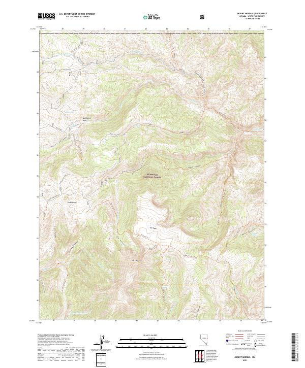
2021 Map of Mount Moriah
USGS Topo · Published 2021About this map
Mt Moriah stands as the dominant peak in this high-altitude landscape within the Humboldt National Forest. The map detail reveals a complex network of drainages and canyons, including Big Canyon, Deep Canyon, and Deerhead Canyon, which carve through the Snake Range. A unique geological feature known as The Table sits north of the primary peak, accessible via a series of pack and forest trails. Water sources are critical markers in this arid environment, with Unqopah Spring, Harnleys Spring, and Chalk Spring providing vital points of reference. The layout of trails like the Moriah Table Four Mile and Water Canyon Loop illustrates how human activity is channeled through the natural topography of the Great Basin's high country.
Find a feature on this map
52 named features on this map. Tap any name to fly to it.
Don’t see what you’re looking for? This feature index may not catch every label — zoom into the map to look around manually.
Map Details
Editions of this 2021 Mount Moriah Map
This is the sole edition of this map. No revisions or reprints were ever made.
Other maps of this area

1956 · Ely
USGS Topo · 1:250,000

1959 · Ely
USGS Topo · 1:250,000

1959 · Sacramento Pass
USGS Topo · 1:62,500

1963 · Ely
USGS Topo · 1:250,000
1986 · Mount Moriah
USGS Topo · 1:24,000
1986 · The Cove
USGS Topo · 1:24,000
1986 · Little Horse Canyon
USGS Topo · 1:24,000
1986 · Sixmile Canyon
USGS Topo · 1:24,000
1986 · Mormon Jack Pass
USGS Topo · 1:24,000
1986 · Spring Mountain
USGS Topo · 1:24,000