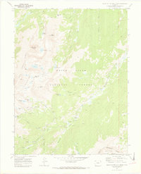
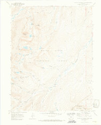
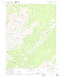
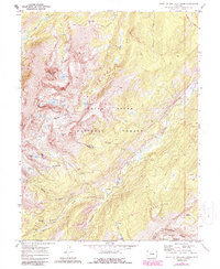
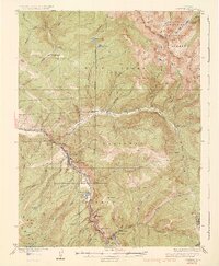
1970 Map of Mount Of The Holy Cross
USGS Topo · Published 1973About this map
Holy Cross City and the surrounding high-altitude mining landscape are meticulously documented in this 1970 survey. The map reveals the intricate water management infrastructure of the era, including the Missouri Collection System, Homestake Aqueduct, and several diversion dams like Sopris Creek and Missouri Creek. This network of aqueducts and the Missouri Tunnel highlights the complex engineering required to transport water through the Continental Divide's foothills.
Find a feature on this map
47 named features on this map. Tap any name to fly to it.
Don’t see what you’re looking for? This feature index may not catch every label — zoom into the map to look around manually.
Map Details
Editions of this 1970 Mount Of The Holy Cross Map
5 editions found

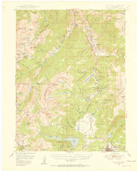
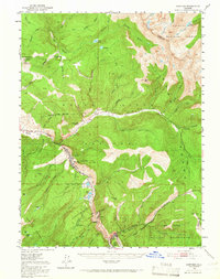
Other maps of this area

1889 · Leadville
USGS Topo · 1:125,000

1891 · Leadville
USGS Topo · 1:125,000

1909 · Mount Jackson
USGS Topo · 1:125,000

1911 · Mount Jackson
USGS Topo · 1:125,000
1934 · Minturn
USGS Topo · 1:62,500

1942 · Leadville
USGS Topo · 1:125,000
1949 · Holy Cross
USGS Topo · 1:62,500
1950 · Minturn
USGS Topo · 1:62,500

1951 · Holy Cross
USGS Topo · 1:62,500

1957 · Leadville
USGS Topo · 1:250,000