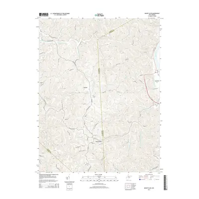
2014 Map of Mount Olive
USGS Topo · Published 2014About this map
Upland and Mount Olive anchor the high ground in this West Virginia landscape, where the headwaters of several drainages meet at the intersection of Mason, Putnam, and Cabell counties. The terrain is defined by the winding course of Eighteenmile Creek and its many branches, including Right Fork Eighteenmile Cr. The eastern edge of the map follows the Kanawha River, where modern transportation corridors like Us-35 run parallel to the water. This 2014 survey reveals a territory with deep roots, evidenced by numerous small family and church burial grounds scattered across the ridges, such as Mt Olive Cem and Staten Chapel Cem. The settlement pattern follows the narrow valleys and ridges, with homes and farms clustered along routes like Ashton Upland Rd and Keister Rd, illustrating a long-standing reliance on the local topography for road placement.
Find a feature on this map
91 named features on this map. Tap any name to fly to it.
Don’t see what you’re looking for? This feature index may not catch every label — zoom into the map to look around manually.
Map Details
Editions of this 2014 Mount Olive Map
This is the sole edition of this map. No revisions or reprints were ever made.
Other maps of this area

1892 · Huntington
USGS Topo · 1:125,000

1898 · Huntington
USGS Topo · 1:125,000

1899 · Charleston
USGS Topo · 1:125,000

1902 · Milton
USGS Topo · 1:62,500

1906 · Glenwood
USGS Topo · 1:62,500

1906 · Winfield
USGS Topo · 1:62,500

1908 · Glenwood
USGS Topo · 1:62,500

1908 · Winfield
USGS Topo · 1:62,500

1909 · Saint Albans
USGS Topo · 1:62,500

1931 · Saint Albans
USGS Topo · 1:62,500