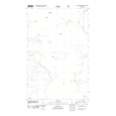
2011 Map of Mount Roothaan
USGS Topo · Published 2011About this map
Mount Roothaan and the Selkirk Mountains dominate this high-elevation landscape in Bonner County, Idaho. The topography is defined by prominent peaks and ridges, including Hunt Peak, Horton Ridge, and McCormick Ridge, creating a complex drainage network. High mountain lakes such as Hunt Lake, Fault Lake, and McCormick Lake are scattered across the high basins, feeding a series of watercourses like Soldier Creek, McCormick Creek, and the South Fork Hunt Creek. The eastern portion of the quadrangle shows the drainage of the Pack River and its West Branch, which are accessed by the lone primary thoroughfare, Pack River Rd. This survey illustrates the remote character of the region, where land use is concentrated around protected areas like Jeru Park and prominent landmarks such as the Chimney Rock Middle Cairn.
Find a feature on this map
23 named features on this map. Tap any name to fly to it.
Don’t see what you’re looking for? This feature index may not catch every label — zoom into the map to look around manually.
Map Details
Editions of this 2011 Mount Roothaan Map
This is the sole edition of this map. No revisions or reprints were ever made.
Other maps of this area

1901 · Sandpoint
USGS Topo · 1:125,000

1911 · Priest Lake
USGS Topo · 1:250,000

1911 · Sandpoint
USGS Topo · 1:125,000

1913 · Priest Lake
USGS Topo · 1:250,000

1958 · Sandpoint
USGS Topo · 1:250,000

1963 · Sandpoint
USGS Topo · 1:250,000

1967 · Priest Lake SE
USGS Topo · 1:24,000

1967 · Coolin
USGS Topo · 1:24,000

1967 · Priest Lake NE
USGS Topo · 1:24,000

1967 · The Wigwams
USGS Topo · 1:24,000