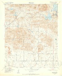
1949 Map of Mount Scott
USGS Topo · Published 1952About this map
The Wichita Mountains Wildlife Refuge dominates this landscape, where high peaks like Mt Scott and Mt Roosevelt rise above a complex network of reservoirs and military land. This mid-century survey reveals a transition between the recreation area and the Fort Sill Military Reservation, which occupies much of the southern and eastern territory. Notable cultural landmarks include the Easter Pageant site near Mt Roosevelt, reflecting the region's historical community traditions.
Find a feature on this map
57 named features on this map. Tap any name to fly to it.
Don’t see what you’re looking for? This feature index may not catch every label — zoom into the map to look around manually.
Map Details
Editions of this 1949 Mount Scott Map
2 editions found
Other maps of this area

1937 · Cache
USGS Topo · 1:48,000

1937 · Quanah Mountain
USGS Topo · 1:24,000

1942 · Cache
USGS Topo · 1:62,500

1946 · Lawton
USGS Topo · 1:62,500

1949 · Mount Scott
USGS Topo · 1:24,000

1949 · Quanah Mountain
USGS Topo · 1:24,000

1949 · Fort Sill
USGS Topo · 1:24,000

1950 · Saddle Mountain
USGS Topo · 1:62,500

1955 · Lawton
USGS Topo · 1:250,000

1956 · Post Oak Creek
USGS Topo · 1:24,000