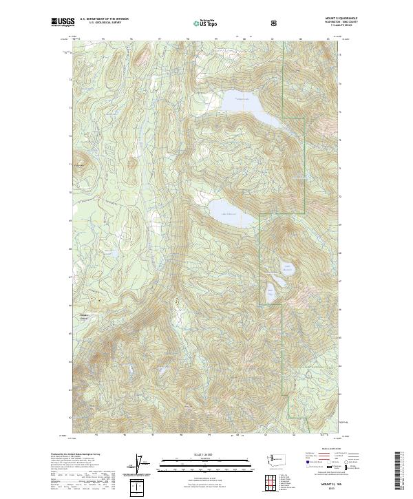
2023 Map of Mount Si
USGS Topo · Published 2023About this map
Ernies Grove and the surrounding high-altitude lake country define this corner of the Cascade foothills. The terrain is characterized by a dense network of water bodies and dramatic elevation changes, notably the iconic peaks of Mt Si and Mt-Teneriffe in the southern reaches. The North Fork Snoqualmie River carves through the central valley, flanked by timber access roads like N Fork Rd SE and Tolt Reservoir Rd. The map reveals a landscape managed for both preservation and utility, with the eastern half largely dedicated to the Snoqualmie National Forest and the Alpine Lakes Wilderness. Numerous smaller basins, including Lake Hancock and Calligan Lake, dot the plateaus, while lower-lying features like Metcalf Marsh near Fuller Mtn illustrate the complex drainage patterns of the Snoqualmie watershed before it descends toward the lowlands.
Find a feature on this map
43 named features on this map. Tap any name to fly to it.
Don’t see what you’re looking for? This feature index may not catch every label — zoom into the map to look around manually.
Map Details
Editions of this 2023 Mount Si Map
This is the sole edition of this map. No revisions or reprints were ever made.
Other maps of this area

1913 · Cedar Lake
USGS Topo · 1:125,000

1921 · Sultan
USGS Topo · 1:125,000

1923 · Sultan
USGS Topo · 1:125,000

1953 · Snoqualmie
USGS Topo · 1:24,000

1953 · North Bend
USGS Topo · 1:24,000

1953 · Lake Joy
USGS Topo · 1:24,000

1957 · Wenatchee
USGS Topo · 1:250,000

1960 · Mount Si
USGS Topo · 1:62,500

1960 · Bandera
USGS Topo · 1:62,500

1975 · Snoqualmie Pass
USGS Topo · 1:100,000