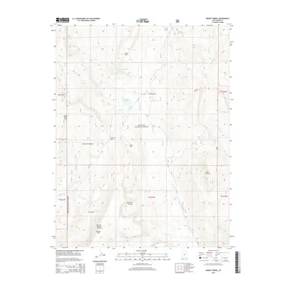
2014 Map of Mount Terrill
USGS Topo · Published 2014About this map
Fishlake National Forest encompasses this high-altitude landscape in Sevier County, dominated by the expansive Fish Lake Hightop Plateau. The area is defined by its significant peaks, notably Mt Terrill and Mt Marvine, which oversee a network of drainages including Tasha Cr and Sevenmile Cr. Glacial legacy is evident in features like the Sevenmile Cirques and the high basins holding Snow Lake and Lake Louise.
Find a feature on this map
41 named features on this map. Tap any name to fly to it.
Don’t see what you’re looking for? This feature index may not catch every label — zoom into the map to look around manually.
Map Details
Editions of this 2014 Mount Terrill Map
This is the sole edition of this map. No revisions or reprints were ever made.
Other maps of this area
1885 · Fish Lake
USGS Topo · 1:250,000
1896 · Fish Lake
USGS Topo · 1:250,000
1956 · Salina
USGS Topo · 1:250,000
1960 · Salina
USGS Topo · 1:250,000
1962 · Salina
USGS Topo · 1:250,000
1966 · Rex Reservoir
USGS Topo · 1:24,000
1966 · Yogo Creek
USGS Topo · 1:24,000
1966 · Gooseberry Creek
USGS Topo · 1:24,000
1968 · Fish Lake
USGS Topo · 1:24,000
1968 · Hilgard Mtn
USGS Topo · 1:24,000