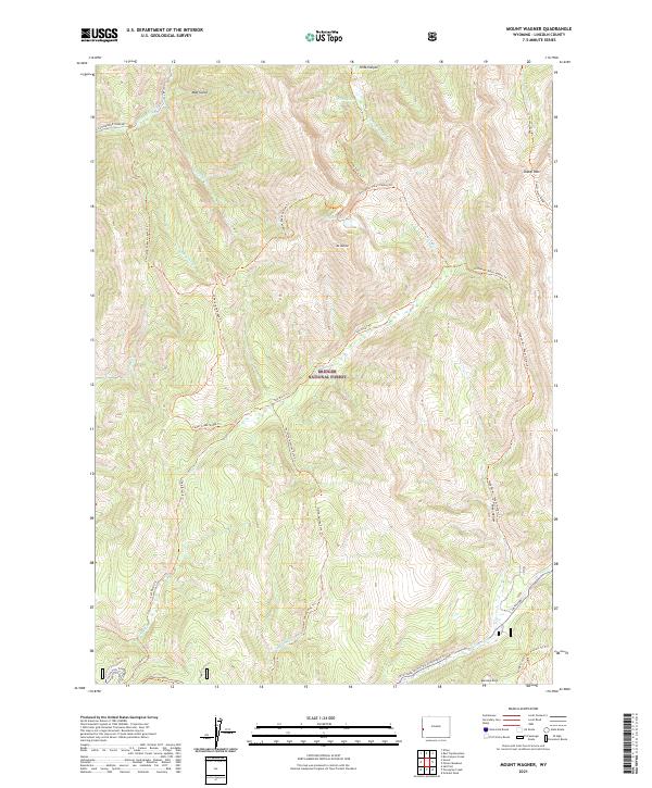
2021 Map of Mount Wagner
USGS Topo · Published 2021About this map
Bridger National Forest encompasses this high-elevation region of Lincoln County, dominated by the massif of Mt Wagner. The landscape is a complex network of ridges and drainages, defined by significant water bodies such as Slide Lake and Wagner Lake. Historically, this area served as a vital corridor for westward expansion, evidenced by the presence of the Lander Cutoff Nat Historic Trl Trl in the southeastern corner.
Find a feature on this map
36 named features on this map. Tap any name to fly to it.
Don’t see what you’re looking for? This feature index may not catch every label — zoom into the map to look around manually.
Map Details
Editions of this 2021 Mount Wagner Map
This is the sole edition of this map. No revisions or reprints were ever made.
Other maps of this area

1921 · Afton
USGS Topo · 1:125,000

1936 · Cokeville
USGS Topo · 1:96,000

1942 · Cokeville
USGS Topo · 1:125,000

1955 · Preston
USGS Topo · 1:250,000

1958 · Preston
USGS Topo · 1:250,000

1962 · Preston
USGS Topo · 1:250,000

1967 · Graham Peak
USGS Topo · 1:24,000

1967 · Porcupine Creek
USGS Topo · 1:24,000
1967 · Salt Flat
USGS Topo · 1:24,000
1980 · Smoot
USGS Topo · 1:24,000