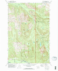
1971 Map of Mount Wow
USGS Topo · Published 1974About this map
Mount Rainier National Park and the adjacent Snoqualmie National Forest dominate this 1971 survey, centered on the prominent massif of Mount Wow. This high-altitude landscape is defined by the headwaters of major river systems, including the Puyallup River and Nisqually River, which are fed by numerous alpine lakes such as Lake George and Lake Christine. The map captures a moment in the early 1970s when the Wonderland Trail and Westside Road provided the primary access for backcountry exploration and management. A poignant inclusion is the Marine Memorial Airplane Crash Monument near Round Pass, which stands as a specific historical marker within the wilderness. Researchers can trace the network of trails and fire access routes like the Jeep Trail that navigated the complex terrain of Emerald Ridge and Klapatche Ridge, offering a clear view of the park's western infrastructure and land-use boundaries between Pierce and Lewis counties.
Find a feature on this map
48 named features on this map. Tap any name to fly to it.
Don’t see what you’re looking for? This feature index may not catch every label — zoom into the map to look around manually.
Map Details
Editions of this 1971 Mount Wow Map
2 editions found
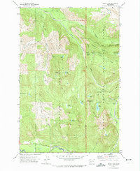
Other maps of this area

1924 · Mt Rainier
USGS Topo · 1:96,000

1928 · Mt Rainier
USGS Topo · 1:125,000

1937 · Eatonville
USGS Topo · 1:125,000

1950 · Yakima
USGS Topo · 1:250,000

1953 · Hoquiam
USGS Topo · 1:250,000

1956 · Mineral
USGS Topo · 1:62,500

1956 · Kapowsin
USGS Topo · 1:62,500

1957 · Hoquiam
USGS Topo · 1:250,000

1958 · Yakima
USGS Topo · 1:250,000

1958 · Hoquiam
USGS Topo · 1:250,000