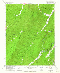
1961 Map of Mountain Grove
USGS Topo · Published 1964About this map
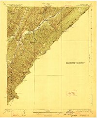
The borderlands of West Virginia and Virginia are defined by the sharp ridges of the Allegheny Mountains in this early 1960s survey. The small community of Mountain Grove serves as a local focal point near the confluence of Back Creek and Ryder Run. The map detail captures a rural landscape where narrow hollows like Kellison Hollow and Stewart Hollow dictate the placement of roads and homesteads. Local social life is evidenced by the Gochran Creek Ch and several small Cem plots, often the only indicators of family homesteads in the deep woods.
Find a feature on this map
81 named features on this map. Tap any name to fly to it.
Don’t see what you’re looking for? This feature index may not catch every label — zoom into the map to look around manually.
Map Details
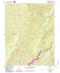
Editions of this 1961 Mountain Grove Map
2 editions found
Other maps of this area

1887 · Lewisburg
USGS Topo · 1:125,000

1891 · Lewisburg
USGS Topo · 1:125,000

1891 · Huntersville
USGS Topo · 1:125,000

1894 · Huntersville
USGS Topo · 1:125,000

1894 · Natural Bridge
USGS Topo · 1:125,000

1901 · Monterey
USGS Topo · 1:125,000

1921 · Callaghan
USGS Topo · 1:48,000
1923 · Marlinton
USGS Topo · 1:48,000
1923 · Warm Springs
USGS Topo · 1:48,000
1923 · Callaghan
USGS Topo · 1:62,500