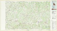
1983 Map of Mountain Grove
USGS Topo · Published 1983About this map
Marshfield and Mountain Grove anchor a landscape defined by the upper reaches of several major Missouri river systems in the early 1980s. The region exhibits a distinct pattern of ridge-top settlements and valley drainage, with the Burlington Northern Railroad running a parallel course to U.S. Highway 60 through Seymour, Mansfield, and Norwood. This transportation corridor reflects the historical development of these Ozark plateau towns, while more remote communities like Competition and Lynchburg remain tied to the surrounding agricultural and timbered lands.
Find a feature on this map
174 named features on this map. Tap any name to fly to it.
Don’t see what you’re looking for? This feature index may not catch every label — zoom into the map to look around manually.
Map Details
Editions of this 1983 Mountain Grove Map
This is the sole edition of this map. No revisions or reprints were ever made.
Other maps of this area

1884 · Springfield
USGS Topo · 1:125,000

1884 · Bolivar
USGS Topo · 1:125,000

1886 · Springfield
USGS Topo · 1:125,000

1892 · Bolivar
USGS Topo · 1:125,000

1907 · Forsyth
USGS Topo · 1:125,000

1931 · Manes
USGS Topo · 1:48,000

1936 · Ava
USGS Topo · 1:48,000

1937 · Buckhart
USGS Topo · 1:48,000

1937 · Bradleyville
USGS Topo · 1:48,000

1937 · Edgar Springs
USGS Topo · 1:48,000