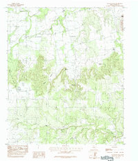
1984 Map of Mountain Pass
USGS Topo · Published 1992About this map
Mulberry Canyon dominates this 1984 study of the Taylor County landscape, where the flat plains give way to a series of distinctive mesas and deeply cut drainages. The topography is defined by prominent elevations like Castle Peak and Bald Mountain, which overlook a network of seasonal watercourses including Mulberry Creek and Nubia Creek.
Find a feature on this map
15 named features on this map. Tap any name to fly to it.
Don’t see what you’re looking for? This feature index may not catch every label — zoom into the map to look around manually.
Map Details
Editions of this 1984 Mountain Pass Map
2 editions found
Other maps of this area

1890 · Abilene
USGS Topo · 1:125,000

1892 · Abilene
USGS Topo · 1:125,000

1893 · Sweetwater
USGS Topo · 1:125,000

1954 · Big Spring
USGS Topo · 1:250,000

1954 · Abilene
USGS Topo · 1:250,000

1957 · Merkel
USGS Topo · 1:62,500

1957 · Buffalo Gap
USGS Topo · 1:62,500

1958 · Big Spring
USGS Topo · 1:250,000

1958 · Abilene
USGS Topo · 1:250,000
1967 · Shep
USGS Topo · 1:24,000