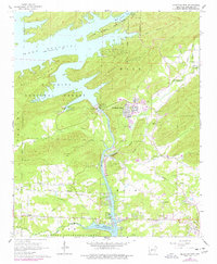
1966 Map of Mountain Pine
USGS Topo · Published 1977About this map
Mountain Pine serves as the industrial and residential hub of this 1966 topographic survey, situated just east of the Ouachita River. The landscape is dominated by the massive water control infrastructure of the Blakely Mountain Dam, which contains the expansive waters of Lake Ouachita. To the south, the Ouachita River flows toward Lake Hamilton, where a system of substations and gaging stations manages the region's hydro-electric potential.
Find a feature on this map
56 named features on this map. Tap any name to fly to it.
Don’t see what you’re looking for? This feature index may not catch every label — zoom into the map to look around manually.
Map Details
Editions of this 1966 Mountain Pine Map
2 editions found
Other maps of this area

1890 · Hot Springs
USGS Topo · 1:125,000

1894 · Hot Springs
USGS Topo · 1:125,000

1955 · Little Rock
USGS Topo · 1:250,000

1956 · Little Rock
USGS Topo · 1:250,000

1960 · Little Rock
USGS Topo · 1:250,000

1962 · Crystal Springs
USGS Topo · 1:24,000

1962 · Avant
USGS Topo · 1:24,000

1964 · Little Rock
USGS Topo · 1:250,000

1966 · Pearcy
USGS Topo · 1:24,000
1966 · Hot Springs North
USGS Topo · 1:24,000