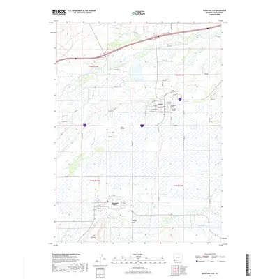
2017 Map of Mountain View
USGS Topo · Published 2017About this map
Lyman and Mountain View anchor this high-plains landscape in Uinta County, where human settlement is defined by an intricate network of irrigation and historical passage. The terrain transition from the broad Poverty Flats to the elevated Tipperary Bench illustrates the agricultural adaptation required in this corner of Wyoming. Life here revolves around the water of the Blacks Fork and Smiths Fork, managed through the extensive Blacks Fork Canal and Fort Bridger Canal systems that sustain the local ranching community.
Find a feature on this map
69 named features on this map. Tap any name to fly to it.
Don’t see what you’re looking for? This feature index may not catch every label — zoom into the map to look around manually.
Map Details
Editions of this 2017 Mountain View Map
This is the sole edition of this map. No revisions or reprints were ever made.
Other maps of this area

1954 · Ogden
USGS Topo · 1:250,000

1958 · Ogden
USGS Topo · 1:250,000

1960 · Ogden
USGS Topo · 1:250,000

1964 · Reed Reservoir
USGS Topo · 1:24,000

1964 · Fort Bridger
USGS Topo · 1:24,000

1964 · Carter
USGS Topo · 1:24,000

1964 · Mountain View
USGS Topo · 1:24,000

1964 · Austin Reservoir
USGS Topo · 1:24,000
1964 · Leavitt Bench
USGS Topo · 1:24,000
1964 · Robertson
USGS Topo · 1:24,000