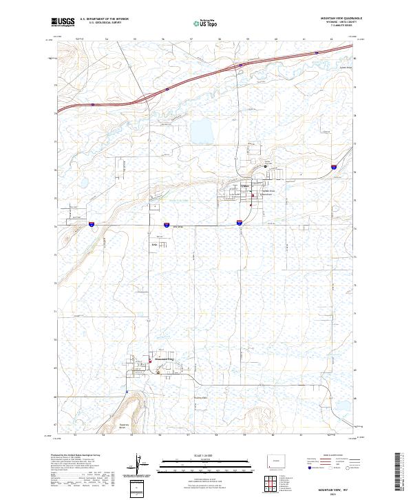
2021 Map of Mountain View
USGS Topo · Published 2021About this map
Blacks Fork and Smiths Fork wind through this part of Uinta County, shaping a landscape defined by traditional agricultural water management. The irrigation network, including the Blacks Fork Canal and the Fort Bridger Canal, supports the three primary settlements of Lyman, Mountain View, and Urie. These towns serve as central hubs for the surrounding ranching and farming operations, with the Lyman City Cem and various local street grids providing clear points of reference for genealogical research. The presence of Emigrant Rd north of the main settlements hints at the deep historical corridors that have long connected this region. To the south, the terrain transitions into distinctive topographical features such as Poverty Flats and Tipperary Bench, while several draws, including Lyman Draw and Urie Draw, cut through the plains towards the river bottoms.
Find a feature on this map
68 named features on this map. Tap any name to fly to it.
Don’t see what you’re looking for? This feature index may not catch every label — zoom into the map to look around manually.
Map Details
Editions of this 2021 Mountain View Map
This is the sole edition of this map. No revisions or reprints were ever made.
Other maps of this area

1954 · Ogden
USGS Topo · 1:250,000

1958 · Ogden
USGS Topo · 1:250,000

1960 · Ogden
USGS Topo · 1:250,000

1964 · Reed Reservoir
USGS Topo · 1:24,000

1964 · Fort Bridger
USGS Topo · 1:24,000

1964 · Carter
USGS Topo · 1:24,000

1964 · Mountain View
USGS Topo · 1:24,000

1964 · Austin Reservoir
USGS Topo · 1:24,000
1964 · Leavitt Bench
USGS Topo · 1:24,000
1964 · Robertson
USGS Topo · 1:24,000