
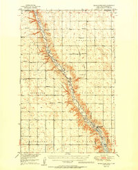
1948 Map of Mouse River Park NW
USGS Topo · Published 1948About this map
The Souris River Valley cuts a deep, winding path through the North Dakota plains, defining the rural character of Renville County just after the Second World War. This landscape is marked by a deliberate network of township boundaries and civic infrastructure, including the jurisdictions of Stafford, Rockford, Prosperity, and Grover. The area's settlement pattern is revealed through the placement of rural institutions such as Edson Ch, Pleasant View Ch, and the nearby Pleasant View Cem.
Find a feature on this map
14 named features on this map. Tap any name to fly to it.
Don’t see what you’re looking for? This feature index may not catch every label — zoom into the map to look around manually.
Map Details
Editions of this 1948 Mouse River Park NW Map
This is the sole edition of this map. No revisions or reprints were ever made.
Other maps of this area

1949 · Mouse River Park NW
USGS Topo · 1:24,000

1949 · Bowbells SE
USGS Topo · 1:24,000

1949 · Bowbells NE
USGS Topo · 1:24,000

1949 · Mouse River Park NE
USGS Topo · 1:24,000

1949 · Mouse River Park SW
USGS Topo · 1:24,000

1949 · Mouse River Park
USGS Topo · 1:24,000

1950 · Bowbells
USGS Topo · 1:62,500
1950 · Mouse River Park
USGS Topo · 1:62,500

1953 · Williston
USGS Topo · 1:250,000

1954 · Minot
USGS Topo · 1:250,000