
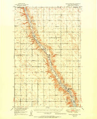
1949 Map of Mouse River Park NW
USGS Topo · Published 1949About this map
The Souris River meanders through the heart of Renville County in this late-1940s survey, following a deep trench across the North Dakota plains. This international borderland sits just south of the Canada United States boundary, where the river valley creates a stark contrast to the surrounding plateau. The settlement pattern is defined by the township system, with distinct districts like Stafford, Prosperity, and Rockford carving out the prairie.
Find a feature on this map
17 named features on this map. Tap any name to fly to it.
Don’t see what you’re looking for? This feature index may not catch every label — zoom into the map to look around manually.
Map Details
Editions of this 1949 Mouse River Park NW Map
This is the sole edition of this map. No revisions or reprints were ever made.
Other maps of this area

1948 · Mouse River Park NW
USGS Topo · 1:24,000

1949 · Bowbells SE
USGS Topo · 1:24,000

1949 · Bowbells NE
USGS Topo · 1:24,000

1949 · Mouse River Park NE
USGS Topo · 1:24,000

1949 · Mouse River Park SW
USGS Topo · 1:24,000

1949 · Mouse River Park
USGS Topo · 1:24,000

1950 · Bowbells
USGS Topo · 1:62,500
1950 · Mouse River Park
USGS Topo · 1:62,500

1953 · Williston
USGS Topo · 1:250,000

1954 · Minot
USGS Topo · 1:250,000